Potent Storm Taking Aim On Minnesota
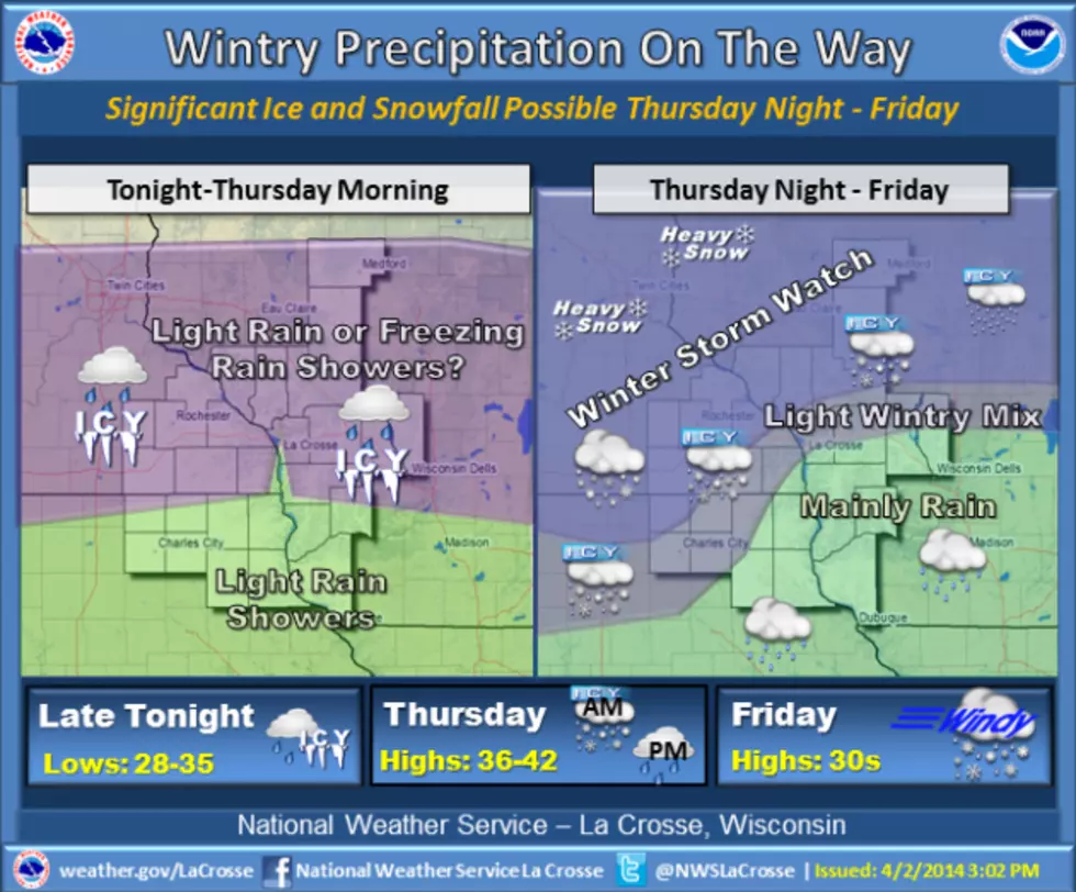
The most recent forecasting models suggest the heaviest snow from an approaching storm system will fall north of the Rochester area, but this region is still expecting a messy mix of rain, freezing rain, sleet and snow. The National Weather Service has now posted winter storm warnings for southwest, central, and east-central Minnesota from early Thursday afternoon through Friday evening. At this point, the heaviest snow is predicted to fall along a line from Redwood Falls and New Ulm to an area just north of the Twin Cities. Forecasters say those areas could see over a foot of snow by the time the storm ends on Friday. The southeast corner of the state is under a winter storm watch because of the possibility of significant icing and heavy snow, depending on the temperature.
More From KOLM - 1520 The Ticket