Rochester Area Now Under Winter Storm Warning

Rochester, MN (KROC AM News) - The beginning of the final week of winter will certainly look like winter in southeast Minnesota.
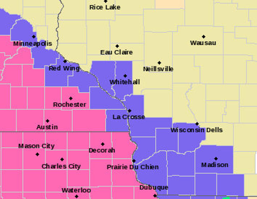
A winter storm warning is now in effect for all of southeast Minnesota, except for Houston and Winona counties.
The National Weather Service says the warning zone could receive 3 - 7 inches of “heavy wet snow” and commuters also face the threat of gusty winds and freezing drizzle.
A heavy snow band will set up across portions of southeast
Minnesota, northeast Iowa into the far corner of southwest
Wisconsin this morning. 1 inch per hour snowfall rates and
visibilities under 1 mile are expected with this band...
significantly impacting travel.
The snow will continue to advance northeast through the rest of
the day, with the heaviest accumulations falling mostly west of
the Mississippi River. As the snow exits, a period of freezing
drizzle is possible...generally from late afternoon into the
evening. Light icing could result, mostly on elevated and
untreated surfaces.
Motorists, be ready for slippery to hazardous conditions. Consider
altering travel plans if conditions warrant it. If you must go
out, be sure to check road conditions prior to departing.
Rochester Public Schools has declared today a traditional snow day, meaning no school online or in person. All after-school activities and athletics have also been canceled.
The snow won’t be around long as temps are expected to be back into the 50s by Thursday.
News update: Mankato man killed in weekend wreck.
Top-10 Odd Minnesota Inventions
More From KOLM - 1520 The Ticket
